Web Japan > Trends in Japan > Food & Travel > Take a Bike Trip and Enjoy Nature in Comfort with Easy-to-Use Equipment
Take a Bike Trip and Enjoy Nature in Comfort
with Easy-to-Use Equipment
Bike trips where you can explore local regions leisurely are very popular. Across the country there are places in Japan where you can enjoy the beauty and the gourmet food of the fleeting four seasons. Among these, starting from the North in order of location, we are pleased to present Aomori, Gifu, the "Shimanami Kaido" which winds its way through Hiroshima and Ehime, and Kochi.

A route that runs alongside the sea from the Tanesashi Coast to Kabushima - Hachinohe City, Aomori Prefecture (Courtesy of Aomori Prefecture)

Islands with black-tailed gulls flying in-between
Located at the northern-most part of Honshu, Aomori Prefecture's Tanesashi Coast boasts a full spread of natural grass to one side, which contrasts beautifully with the blue sea.

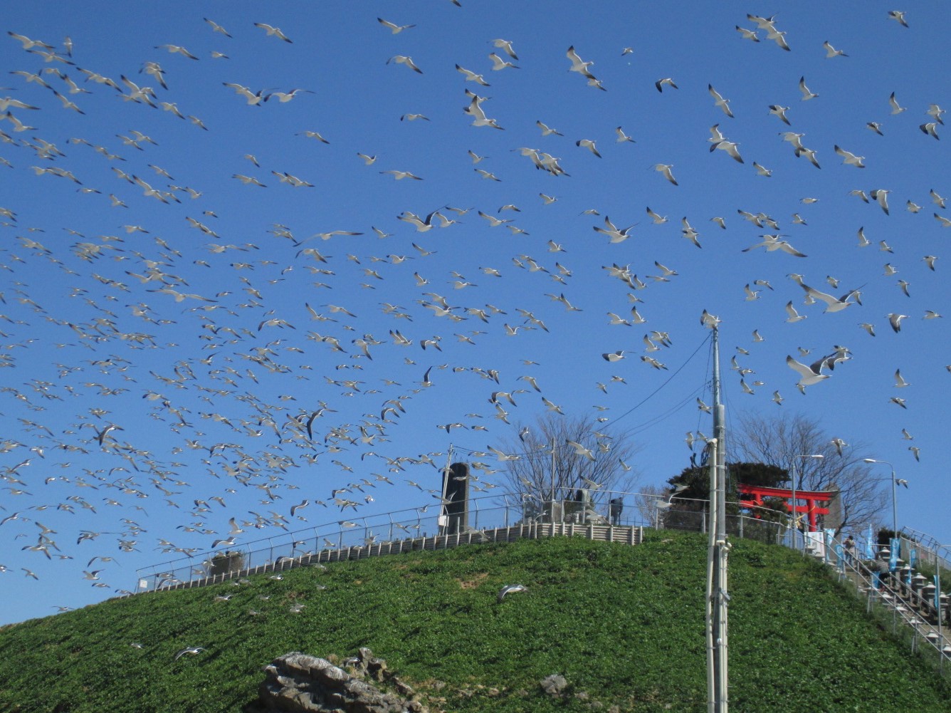
Black-tailed gulls flying over Kabushima – Hachinohe City, Aomori Prefecture (Courtesy of Same Tourist Association)
Heading north along the coastline from the Tanesashi Coast towards Kabushima, there is a 10 km (6.2mile) route that is recommended for cycling. As you approach the destination, Kabushima, you can see the black-tailed gulls flying in the sky. It is the only breeding ground for black-tailed gulls in Japan, and is home to some 30,000 birds - a precious place where you can observe the birds nesting close up.
The Tanesashi Tourist Association rents out electric bicycles. The bicycles even come with an audio route-guide which is currently only provided in Japanese due to the fact that the service is not often used by foreign tourists.
There are also other wonderful routes in Aomori Prefecture that are worth cycling at least once, such as "Apple Road" that passes through fields of apples (a local specialty) and the "Towada Lake Green Road" that runs alongside mountain streams.


“Towada Lake Green Road” - Towada City, Aomori Prefecture (Courtesy of Aomori Prefecture)
Japan's Machu Picchu

If you get off your bike and walk up the mountain path for about 20 minutes, you get a fantastic view of so-called “Japan's Machu Picchu”
In Gifu Prefecture, which lies roughly in the center of Japan, there is a cycle route that offers superb views for your enjoyment. It starts at Ikeno Station (in Ikeda Town, Gifu Prefecture) on the Yoro Railway Line and heads towards Ikeda Onsen (hot springs) along a 38 km (23.6mile) route that takes 170 minutes. The focal feature of the route is the superb view of the tea plantations (at Ibigawa Town, Gifu Prefecture) - the so-called "Machu Picchu of Japan". The green tea plantations spread out across the mountain face at an altitude of 300 meters.
Ikeda Hot Springs are equipped with colorful, contemporary outdoor baths and are popular with young people too.

You can rent electric bikes at Ikeno Station, among other places. Municipalities along the Yoro Railway, such as the towns of Ikeda and Ibigawa, are improving their capacity to handle foreign tourists. Starting in the fall of 2017, they are offering a smart-phone app on recommended cycling routes in the region in English and Chinese. Tourist information will also be rolled out in English and Chinese and will include information on around 100 sightseeing spots, food and drink available at nearby facilities, and local souvenirs etc.
A cycle route that runs for 70 km in total
The Seto Naikai (Seto Inland Sea) located in the southwest of Japan is known for its temperate climate. Located in the west of the Seto Inland Sea is "Shimanami Kaido" - a cycle route approximately 70 km (43.5mile) long that passes through the islands of the "Geiyo Archipelago" linking Onomichi in Hiroshima Prefecture with Imabari in Ehime Prefecture; a route that is popular among people from all over the country. Information on the route is provided on the Internet in English, Chinese and Korean.
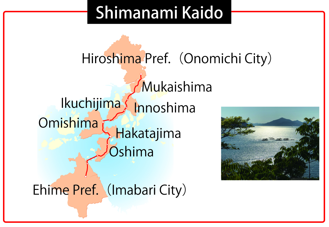
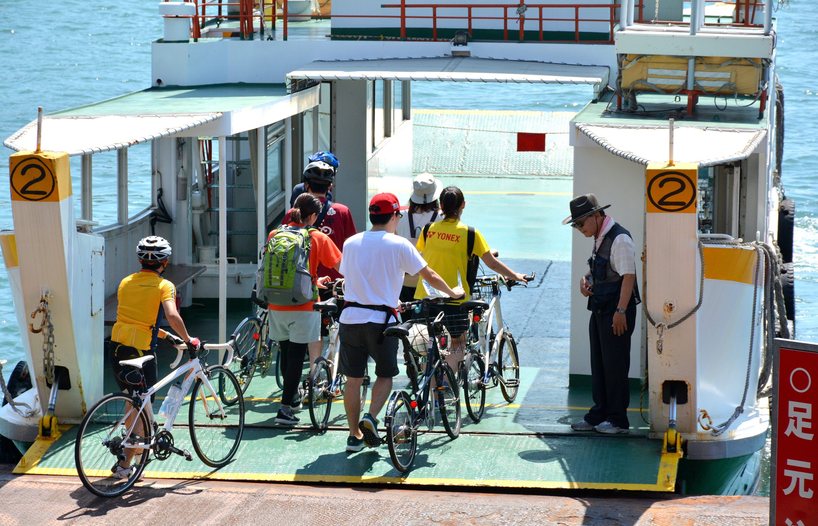
Crossing from Onomichi to Mukaishima, there is no cycle/pedestrian lane on the first bridge - the "Shin Onomichi Ohashi" - so it is recommended that cyclists and pedestrians use the "Eki-mae Tosen (ferry in front of the station)" from outside Onomichi Station to make the crossing to Mukaishima. You can get on the ferry with your bike and arrive on Mukaishima in about 5 minutes.
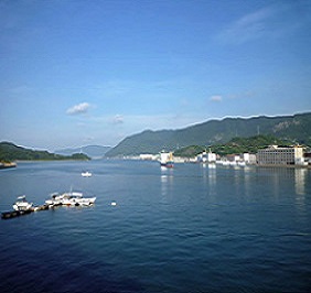
The view from Mukaishima towards downtown Onomichi (Seaside Hostel Light House)
From Mukaishima, each of the bridges linking Innoshima, Ikuchijima, Omishima, Hakatajima, Oshima and Imabari has dedicated cycle/pedestrian lanes. Be sure to enjoy the spectacular scenery as you walk or cycle your way across the Seto Inland Sea!
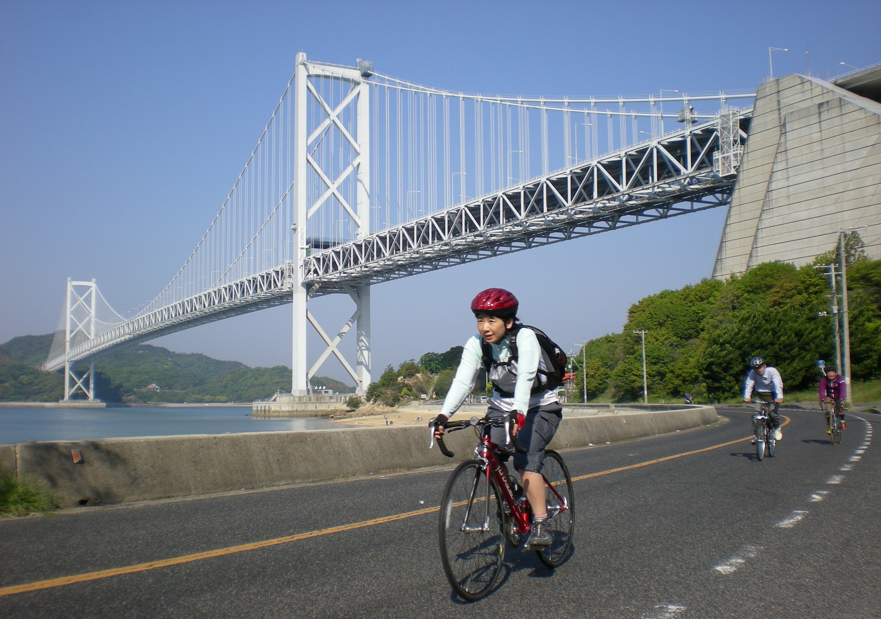
The Innoshima Ohashi (Innoshima Great Bridge) which can be seen above, links Mukaishima and Innoshima and is a 2-level structure with a cycle lane for bikes on the lower level (Shimanami Kaido)

On the left of the roadway on the Shimanami Kaido Cycleway, there is a blue line showing the recommended cycle route to allow cyclists to make their journeys without getting lost.

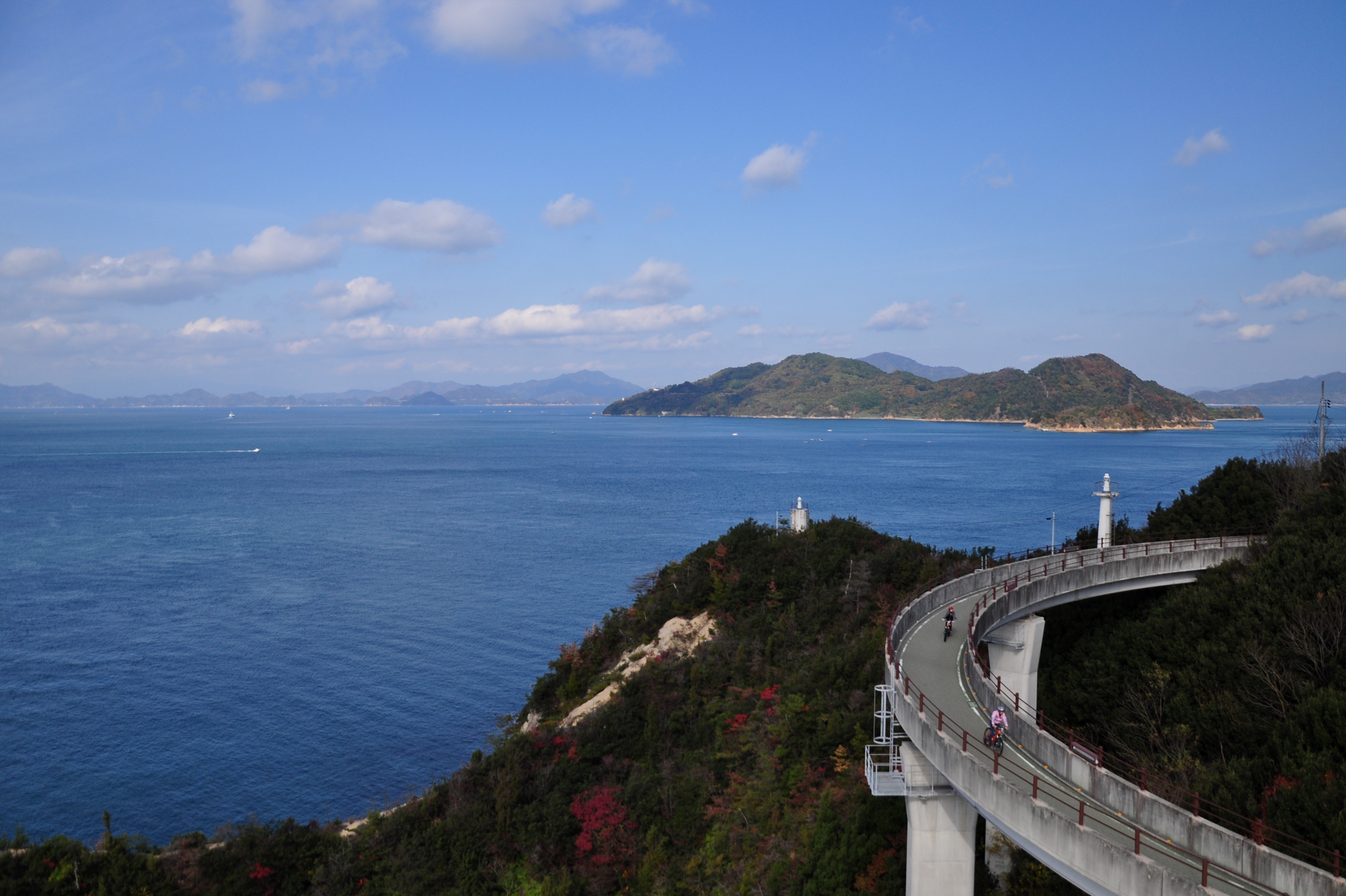
The Kurushima Kaikyo Ohashi :Great Bridge across the Kurushima Straits (Shimanami Kaido)
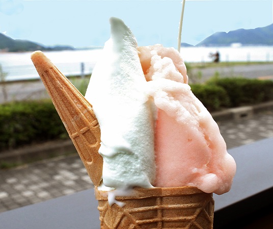
How about an ice-cream mid-way through your ride? These two flavors use peaches from Onomichi and salt from the Seto Inland Sea (Dolce Setoda Main Store)
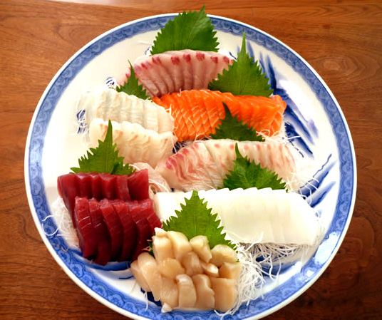
At many of the lodges used by cyclists, you can also order Sashimi with fish from the Seto Inland Sea (Seaside Hostel Light House)
As you ride your bike with the sea breeze on your face, you should try the abundant fruits of the sea (the Seto Inland Sea) and the desserts made from local specialties.
Cycle alongside clear streams

In Japan, where close to 70% of the country is covered in forests, more than 35,000 rivers flow through the forests and pour into the sea. Among these is the Shimanto River, one of Japan's top "seiryuu" (meaning "clear streams") which flows a total length of 196 km (122 mile) through places such as Shimanto City in Kochi Prefecture. There is an increase in the number of overseas tourists who, drawn by the rustic landscape, follow the river on their bikes.
The secret of its popularity are the navigational devices attached to the rental bikes. As well as Japanese, these give audio instructions in English, Chinese and Korean to take you to your destination; instructions such as "go straight, as you are" or "turn right", "turn left" etc. Taking safety into account, the device uses headphones for audio instructions that do not block the ears.
As well as giving directions, the device also warns you of spots where visibility is poor. It also provides details on viewing spots for dozens of tourist attractions, saving you time in preparing for your trip.


You can still hear surrounding sounds as the headphones don't block the ears (Courtesy of Forte)
Most popular is the 22.5 km (14 mile) route around the lower reaches of the Shimanto River, which takes about 2 hours. In springtime, around 3 kilometers (1.2mile) into the ride the "Nyuta Willow Forest" spreads out, displaying approximately 10 million rapeseed blossoms in flower. In fall, the red spider lily is the main contender.


The most popular spot on the route is the Shimanto River's famous "Sadachinka Bridge." A "chinka" bridge (a bridge designed to cope with floods) has no parapets or decorations and sinks into the river when water levels rise to protect itself from collapse. The bridge is so narrow that cars cannot pass one another, and it is quite a thrill even for fellow cyclists to get by each other. There are a total of 47 "chinka" bridges on the Shimanto River, including its tributaries.
Traditional river fishing also continues in the Shimanto River and you can catch a glimpse of farmers hard at work in the river basin's fields and paddies.
There is also an increase in the number of areas developing initiatives to allow visitors from overseas to enjoy the fun; initiatives such as information, route guide tools and apps etc., in multiple languages. Why not try a "bike trip" where you can experience Japan's natural beauty, taste local culinary specialties and interact with the local people?
© Web Japan, 2017