NIPPONIA No. 37 June 15, 2006
Archipelago Dynamo
Windbreak trees in Nakashibetsu-cho
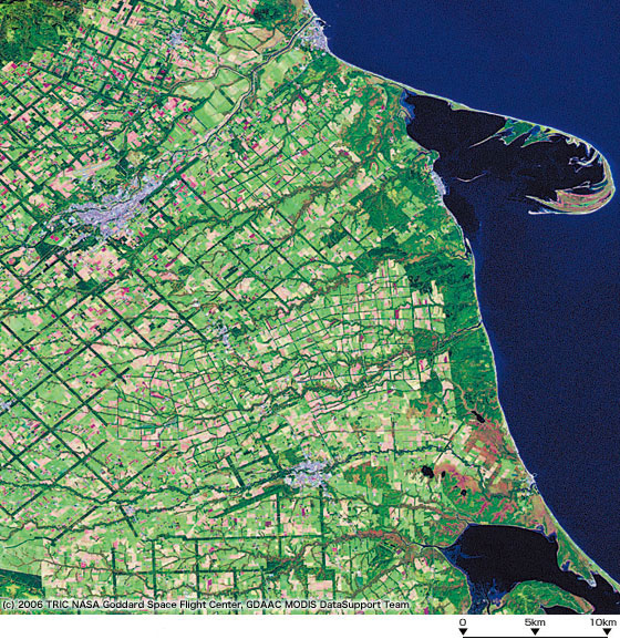
Astronauts say this unusual checkerboard pattern in Hokkaido can be seen even from orbit. The sides of the squares are each about 3 to 4 km long, and the total length of all sides is 648 km. The lines for the squares are actually trees used as windbreaks (width: 180 meters) sheltering people and farmland from strong winds and snow.
Thanks to the trees, the land now produces bumper crops.
(Photo: Tokai University Research and Information Center)

Tokyo Bay Aqualine
The Tokyo Bay Aqualine motorway links Kisarazu (Chiba Prefecture) on one side of the bay with Kawasaki (Kanagawa Prefecture) on the other. The 4.4 km bridge takes motorists from the Kisarazu side to a rest area on an artificial island called Umi Hotaru. The highway then suddenly vanishes from the surface into an undersea tunnel. Convenience for motorists is balanced with a reduced impact on nature. The white structure at the top right of photo is the upper part of the tunnel's ventilation shaft.
(Photo: JTB Photo)