|
NIPPONIA No.25 June 15, 2003
|
|
Special Feature*
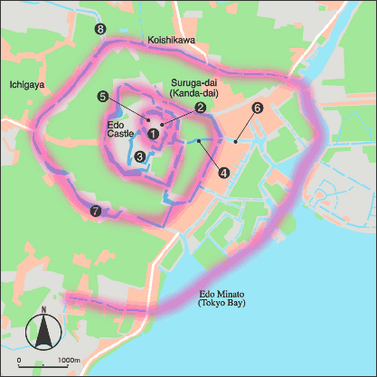
The city of Edo — clockwise development pattern (1670)
 |
|
 |
Hon-maru |
 |
Ni-no-maru |
 |
Nishi-no-maru |
 |
Dosan-bori |
 |
Site of main tower |
 |
Nihombashi |
 |
Tameike |
 |
Old Hira River
(now Kanda River) |
|
Land for military gentry |
|
Land for commoners |
|
Other land use |
|
In the early 1600s, Edo Castle only had hon-maru and ni-no-maru enclosures. The castle defense works and the city expanded as the moat system was extended in a clockwise spiral pattern, using rivers. Hills were excavated to make flat land, and parts of the bay were filled in to create residential land for the daimyo lords and space for artisans, merchants and other townspeople. Urban planning made Edo into an immense city.
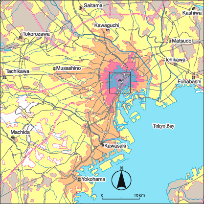
From old Edo to modern Tokyo (Square in center shows area of map above)
 |
|
|
1632 |
|
1670 |
|
1888 |
|
1945 |
|
Present |
|
Railways |
|
Expressways |
|
Edo was a huge city by the 1700s. The name changed to Tokyo in 1868. The subsequent construction of railways prompted further growth. Expressways were constructed in time for the 1964 Olympic Games, further extending the reach of Greater Tokyo. The metropolis continues to expand today.
|